[ hiking introduction ] [
cordillera central ] [
north
] [ south ] [
hiking tips ]
|
|
Hiking Introduction
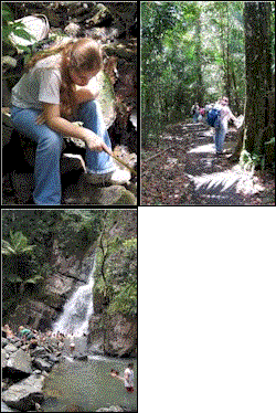
Hiking locations in Puerto Rico are scattered throughout the island in a network of vast forests and mountainous regions known collectively as the Commonwealth Forest Reserve.
Trails are situated within various settings including multiple grades of tropical jungles and rain forests, karst and mangrove forests and subtropical dry lands. You'll have the opportunity to see plenty of rare trees, plants and wildlife on your hike. Recreational facilities and information centers are also available at many locations.
|
|
TOP
|
|
The Cordillera Central
Huge mountain forests blanket the country side at several locations
along the Cordillera Central. The Cordillera Central is an extensive mountain
range that transects the Island east to west. The forests here offer visitors
some excellent hiking trails. The Carite Forest is located in the east section of
the Cordillera, east of Cayey. The Forest has a short winding
trail that ends at the Charco Azul Recreational area pond. The Guavate Recreational Area
is at the opposite side of the Forest. Just above the town of Juana Díaz the
Doña Juana Recreational Area in Toro Negro Forest offers a great hour hike to
an observation tower, Salto de Dona Juana (waterfall) and a public swimming pool. Just west of
Adjuntas, south on route 131 is the Guilarte Forest. It
has a half-hour-long hiking trail to Guilarte Peak and visitors center.
Finally, off route 120, and north from Sabana Grande is the Maricao Forest.
You'll find an
observation tower, Salto Pepe Curet (waterfalls), a fish hatchery, and more opportunity for hiking.
|
|
TOP
|
|
North
El Yunque Caribbean Rain Forest is located in the northeast region of the
Island. It features one of the most popular hiking sites on the largest area of
forest in Puerto Rico. There's over 13 miles (20.8 km) of trails, some of which can take as long as 4 hours to complete.
A favorite trail is the 30-minute walk to La Mina waterfall from the Palo Colorado Visitor Information Center & Picnic Area. Most of the trails and all of the facilities begin from Route 191.
South of Arecibo lies a network of facilities that blend geological
sightseeing, walking and hiking. These facilities include the Rio Camuy
Cave Park, the Arecibo Observatory and La Cueva de Camuy.
The Cambalache Forest, lies west of Barceloneta off route 682 at Km 6.6. In addition to hiking
this facility offers camping and a 3.5 km mountain bike run. In Isabela the Guajataca Forest off route 446 features
about 25 miles of well-marked trails along the typical karsts landscapes of this
region. It's the largest hiking trail system on the Island. Experience hours of
pleasant hiking along low-lying hills. Encounter some of the 186 species of
trees, and 45 species of bird along the way. Camp grounds and an observation tower
are also available. A
fine display of tropical karsts landscape is defined by a landscape of numerous cone-shaped hills covered in tropical vegetation. These natural forms are caused by rainwater
wearing away the region's porous lime stone. Bring a flashlight just in
case you decide to descend the ladder into La Cueva del Viento where you'll find
stalagmites, stalactites and other sediment formations.
|
|
TOP
|
|
South
Starting from the southeast, Aguerre Forest, located between
Arroyo and Salinas, features a nice walking trail. Another great hiking spot is situated southwest of the Island in the 1,640-acre Guánica Dry Forest. This subtropical arid region features 12 major hiking trails.
Passed Guánica, in the southwestern most tip of the island, the Cabo Rojo
National Wildlife Refuge in Boqueron offers a quaint trail, along farmstead
ruins and a visitor Center.
|
|
TOP
|
|
Hiking Tips
Many of the Forests in the Commonwealth Forest Reserve contain
trails with various levels of difficulty. You'll find trails that are good for all
ages, and some that require the company of an experienced guide. Call
ahead to find out what accommodations are available for wheelchairs. Visitors
who are not in good physical condition and pregnant women should consider the
less arduous route. Visitors should wear protective clothing, such as long pants, rain gear and
touch shoes. Sunscreen, personal drinking water and a compass is also a
good idea. Some of the trail site may require permits. Some locations offer mountain bike trails, and some permit camping with permission.
For more information, call the Department of Natural & Environmental Resources at (787) 724-3647.
|
